The first tangible indications of people in the headwaters of the Missouri area are located at the Schmitt Chert Mine on
the western bluffs above the Missouri River, about a mile downstream from the convergence of the Jefferson, Madison and
Gallatin Rivers. Here, archeologists have uncovered signs that tribes classified as the "Pelican Lake Culture" used the
chert mine, work area and encampment between 1350 BC and 350 AD. Chert is a glassy rock from which tools can be produced.
The site was recognized as a possible significant find by local William Kolokotrones on the Floyd Schmitt property, and
Professor Leslie Davis of Montana State University of Bozeman led the archeology effort. Other evidence of early people is
located at the Madison Buffalo Jump, which was used from 300 BC to the 1700s.
Many Native American tribes raided, claimed or visited the headwaters area. Most notable were the Blackfeet, Shoshone,
Hidatsa (Minnetaree), Lacotah and Absaroka (Apsaalooke or Crow). The Lemhi Shoshone girl Sacajawea (local spelling) was
captured at about the age of 12 by raiding Hidatsas in the area in 1800. Some speculate that her capture site is about a
mile west of the City of Three Forks on the Jefferson River. She returned to the area in 1805 as an interpreter for
Captains Lewis and Clark on their way to the west coast, exploring the area of the 1803 Louisiana Purchase. She came again
to the area in 1806 with Captain William Clark and his men on their way back east via the Yellowstone River basin.
Many mountain men came to the area to hunt and trap beaver, which Lewis and Clark had noticed were plentiful in the area.
Among those stouthearted men was John Colter, who had his famous run from the Blackfoot in 1809. In 1810, a party of men
of the Missouri Fur Company (including Colter), led by Andrew Henry and Colonel Pierre Menard came to the headwaters with the
intent of setting up a trade post. This ill-fated expedition was chronicled by Thomas James, a member of the company. They
arrived on April 3, 1810 and constructed a fort made of cottonwood. George Drouillard or "Drewyer," who had also been to the
area with Lewis and Clark, was killed by natives, as were several other men of the company. The fort was abandoned within a
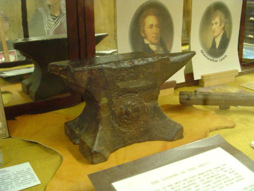
few months, and the survivors of the company split up and went in several directions. A now disproved legend had it that
the company left behind an anvil. It is certain that it was later recovered by settler and blacksmith James Alpin in the 1860s, who used the
anvil in his shop at Gallatin City. The anvil tied to that legend now resides in the Headwaters Heritage Museum. Probably
produced after 1843 and not part of the early expeditions to Montana, the anvil is nonetheless the oldest anvil in Montana.
Other remnants and artifacts from the fort were said to be recovered by various early settlers.
Several other fur company parties came to the headwaters area between 1810 and the late 1830s, including two parties led by
Jim Bridger, but all had difficulty establishing trade relations with the Blackfoot tribes that claimed the area until the
late 1830s. Shortly after trade was established, a smallpox epidemic decimated the tribes in the Rocky Mountain region.
By then, Eastern Americans were more interested in buffalo than beaver.
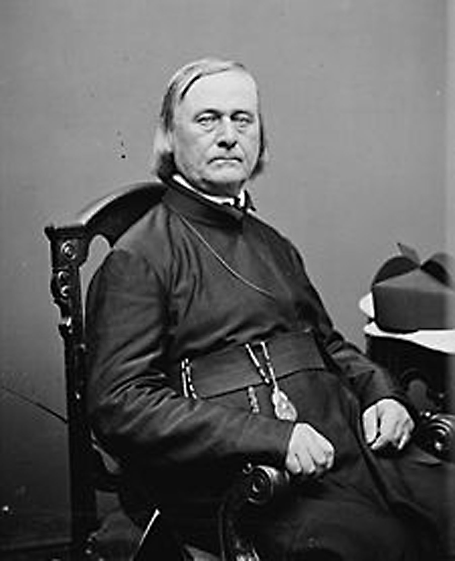
In 1840-1841, Father Pierre Jean De Smet, a Jesuit priest, made three trips through Montana as a missionary to preach
Christianity to the Native Americans. On one trip, his party was at the headwaters of the Missouri. It was here that
Christianity was first preached in the state of Montana. Fr. De Smet baptized Chief Tjolzhitsay (Big Face) and Chief
Walking Bear of the Pend d'Oreilles as well as some 350 tribal members. In 1851, the area around the headwaters of the
Missouri was designated as Blackfeet territory in the Fort Laramie Treaty. Father De Smet drew the map that established
the boundaries and was a proxy for several of the tribal nations that did not have representatives at Fort Laramie.
A trickle of men came to the area between 1840 and 1860, but in 1862, the cry of gold in the region and the need to feed all those
hungry miners, brought farmers from all over the country into the headwaters area. They came over the mountains from the
Bannack area into the Willow Creek basin, or overland following the Missouri River from Fort Benton, or over the mountains
from the Yellowstone basin on the Bozeman Trail. In 1862, a group of men, mostly from Missouri, established the "Gallatin
Town Company" and asked E.N. Burris to lay out the town of Gallatin City, the first established town in the area, to be
located on the west bank of the Missouri opposite the mouth of the Gallatin River. This location was selected because of
the confluence of trails, but the group also assumed that the river would allow steamboat travel. But the Missourians did
not reckon on the great falls, so their hopes of a direct St. Louis to Gallatin City travel route were dashed. This
disappointment and higher traffic volumes on the eastern shore conspired to force the few residents to pick up and move
across the river to an area between the Madison and Gallatin Rivers. This was also named Gallatin City (designated Gallatin
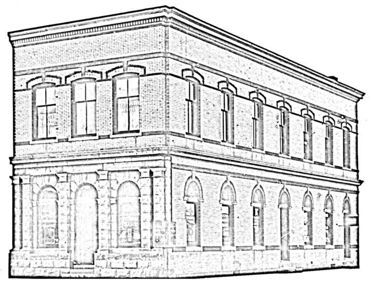
City II by local historians). The remains of Gallatin City II's first hotel still stand near the orientation plaza of the
Headwaters State Park. For a time, Gallatin City was the county seat and vied with several other cities to remain so but
eventually lost to Bozeman.
The headwaters area was a crossroads of sorts, with trails to Bozeman, Last Chance Gulch (Helena), Fort Benton, and the
southwest gold country of Bannack and Virginia City. In 1864, James Shedd took advantage of the situation and built
several toll bridges in the headwaters area and eventually established a way station and inn for weary travelers. His
enterprise was variously called Bridgeville, The Bridges, Madison City, Madison House. In 1882, two Englishmen platted
the town of Three Forks (now known as Old Town Three Forks) between two of Shedd's bridges, one on the Madison River and
one on the Jefferson River. Looking at the plat of Three Forks, the two entrepreneurs had hopes that the Utah and
Northern railroad would run along the western edge of the town.
While the miners in southwest Montana were crying "gold!" the farmers of the headwaters area were crying "land!" The
settlers and miners were desperate to get official deeds to their land, which required a survey and an initial point
from which to derive those surveys. So the Washington bureaucracy ordered that an initial point be established, strongly
suggesting that the landmark called the Beaverhead (near Dillon) be used for that purpose. Decorated Civil War hero
Brigadier General Solomon Meredith was appointed Surveyor General. Upon arrival in Bannack and subsequent review of the
area, he felt the Beaverhead was not appropriate. He hired Benjamin Marsh to establish Initial Point just south of
present day Willow Creek and had a recommendation from cartographer Col. De Lacy to back him up to the folks back in DC.
There was a bit of a red tape problem getting Marsh his money for the contract, but it was eventually settled. Two
reasons were given for the initial point at Willow Creek, one was a clear line of sight for 20-30 miles in every
direction, and the other was the concentration of the population in the Gallatin Valley at the time.
Area History Main Page
Headwaters History Page Two - 1860s to 1890s


